In the Age of Discovery, the term ‘Spice Islands’ referred to two tropical island groups in modern day eastern Indonesia which were, at the time, the only sources of nutmeg and cloves across the entire extent of the globe.
Of course, other spices, like pepper and cinnamon were also in great demand, but these came from other islands; respectively largely from Sumatra and Ceylon. To muddy the definition of the Spice Islands further, enterprising colonial horticulturalists ‘stole’ both nutmeg and clove seedlings from their impossibly remote sources, planting them elsewhere in the tropical zone in which they could survive.
Hence, we have isles like Zanzibar, Penang and Grenada also today calling themselves the ‘Spice Islands.’
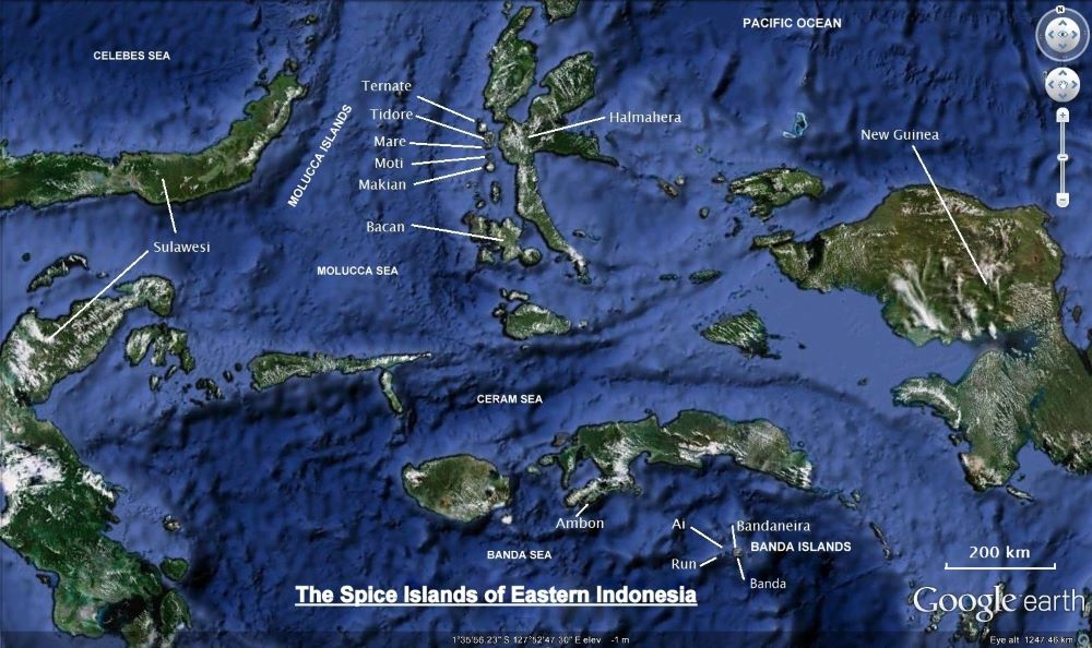
The real Spice Islands; the Moluccas
By some bizarre divine intervention, cloves originally grew only in an island group called the Moluccas. These comprise the comparatively largish Halmahera Island, west of New Guinea and east of Sulawesi, but more importantly, a group of spectacular, soaring stratovolcanoes lying off Halmahera’s western side.
The chain of volcanoes begins on Halmahera with one of the world’s most active volcanoes, impossibly remote 1200 metre Dukono, which has been exploding since 1933 and is putting a 2000 metre plume of ash into the sky as I write; then angry Ibu; 1600 metre Gomkonora, which has erupted violently every decade for the last century; 1100 metre Jailolo right on the coast; then offshore to the core clove islands.
From the north, there is Ternate, then Tidore, Makian–all towering pyramidical volcanos–and, a distance to the south across the equator, larger Bacan (or Bakian). Most famous were the two sultanates of Ternate and Tidore, which in pre-colonial times fought each other constantly while competing for control of the surrounding region. Their tiny islands, both dominated by stratovolcanoes over 1700 metres high– lay just two kilometres apart.
The largest yields of cloves came from those four main islands, with smaller quantities from Halmahera and other scattered isles nearby. Initially, clove trees grew wild in the equatorial jungles that sprung from the rich volcanic soil. Later, trees were propagated into plantations. Clove trees could bear for up to 300 years, and each one could yield 20 kilos of clove buds a year.
Chinese records show that cloves were required to be chewed as a breath freshener by anyone in the emperors presence 300 years before the time of Christ. These undoubtedly came from the Moluccas. There was no other source at that time.
Cloves were also distributed across the Indian Ocean to the glittering courts of the Abbasids at Babylon, in the Middle East, and later, on to Europe. Apart from oriental breath fresheners, they were used as medicine, preservatives, flavouring, and even reputed to ward off the plague.
While the Moluccans themselves were somewhat blessed by providence bestowing them with cloves, in practice it led to exploitation, warfare and conquest. Nothing else was grown on the clove islands, so all foodstuffs, clothing and implements needed to be imported. Needless to say, very expensively.
Today, the Moluccas form one of Indonesia’s lest populated, most remote and under-developed provinces, Maluku Utara. With its capital at tiny Soffifi on Halmahera, the province contains around 1.25 million people, including around 200,000 in Ternate, the largest city. Cloves are still widely grown throughout the Moluccas, but also in other parts of Indonesia – still the world’s largest producer of this famous spice.

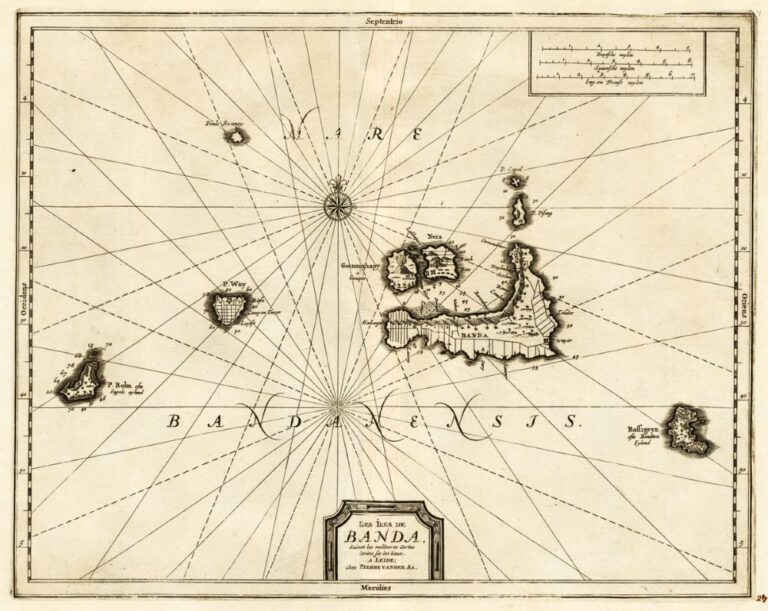
The real Spice Islands; the Banda Islands
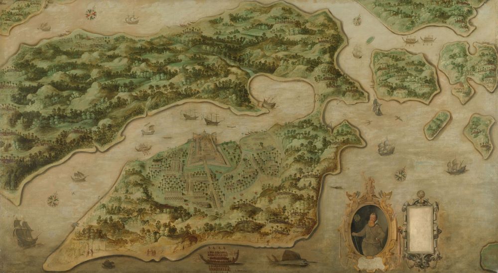
If you left the Moluccas and sailed 300 sea miles south then turned south-east around Ambon for another 100 miles, you’d find yourself in the Banda Sea, and eventually yet another volcanic cone would rear up. This would be 666 metre Gunung Api, chief landmark of the Banda Islands; another volcano quite regularly venting sulphur and steam, ejecting lava or shaking the surrounding islands.
Like the Moluccas, the Bandas were also legendary islands because they were the only places on the face of the earth that grew nutmeg trees. From these trees came a sour plum like fruit that encased a nut wrapped in a bright membrane. The nut was nutmeg and the membrane known as mace. Both were in huge demand across the entire globe as a sweetener and flavourer.
The Bandas are made up of Gunung Api, the volcano, a smaller island nearby, Banda Neira which contains the main township, a larger island five sea miles long called Lonthor, and spread around this central cluster, another three islands; Rozengain to the east and Ai and Run to the west.
The Bandas were even more remote than the Moluccas. Back in pre-colonial times, the closest main trade port was on Java, 1000 sea miles or two weeks sail to the west. They lay in the paths of the east and west monsoons which swept softly across the great archipelago from New Guinea and then back to Java. In the sheltered anchorage under the looming Gunung Api volcano lay dhows and junks and jongs, all filling their holds for the long haul to the west or north, the first elements of a web of trade that extended from these impossibly remote islands to the court of the Emperors in Peking, the Abbasids in Babylon and the Hanseatic merchants of the Baltic Sea.
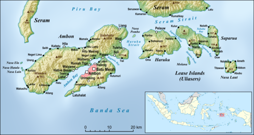
Focal point of the Spice Islands; Ambon and the Lease Islands
Lying between the Moluccas to the north and the Bandas to the southeast, Ambon is today the capital of the Indonesian province of Maluku. Historically it held some wild spices, and these were supplemented by later Dutch plantations, but Ambon’s main role was always as a great safe harbour, protecting shipping from the monsoons.
Ambon was much larger in area than the tiny volcanos of the Moluccas and the Bandas, held a greater population, and provided foodstuffs to the other Spice Islands which lacked the space to grow anything apart from cloves or nutmeg.
The Portuguese, the Dutch, the British, the Japanese and the Indonesians all used Ambon as their major regional headquarters because of its unparalleled strategic location. It guarded the south flank of the Spanish (and later American) Philippines, the east approach to the Dutch Indies, dominated the Spice Islands and the sandalwood island of Timor, and later, guarded the approaches to Australia’s northern outpost of Darwin.
Today, Maluku has around1.5 million inhabitants. Ambon itself holds around 400,000 and is the only significant city in Indonesia that is predominantly Christian. It remains a major port and has an important airport as well as Pattimura University. The Lease Islands stretch east of Ambon itself and north and west are the large islands of Buru and Seram. The province extends across to Irian Jaya and down to Timor.
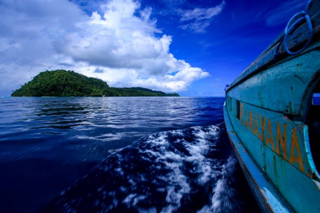
On the edge of the Pacific and on the eastern margin of the great sweep of the Nusantara archipelago – comprised of the modern Philippines and Indonesia nations– the Spice Islands today slumber languidly through the equatorial seasons, forgotten by the world that once sought them so eagerly; still scarred by the wars that consumed them during the colonial period and before, as adventurers and traders mapped the world seeking those legendary Spice Islands.
The Spice Islands remain remote and difficult to access, but for the intrepid visitor these spectacular islands and their attendant history will not quickly be forgotten.