Closing the globe’s circumference for the first time.
On the 8th of November 1521, two battered carracks dropped anchor at Tidore, in the Spice Islands. They were the last survivors of a squadron of five Spanish ships and 270 men that had left Seville on 10th August 1519, under renegade Portuguese commander, Ferdinand Magellan.
It had been an action-packed and epic voyage so far. Before even finding the channel around South America upon which the entire venture depended, Magellan had faced an armed mutiny, eventually beheading or marooning the ringleaders. Then one ship scouting ahead had been wrecked in a storm. Another deserted and returned to Spain.
After a gruelling winter transit of the narrow, twisting strait that now bears his name, Magellan’s three remaining ships entered the Pacific Ocean on 28th November 1520 with around 170 men left. Crossing this immense ocean–the first mariners to do so–took three gruelling months of hardship and privation, as they unluckily missed almost every island between South America and Guam. Twenty sailors died en-route.
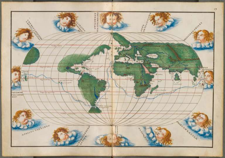
A 1544 world map by Genoese cartographer Battista Agnese, showing both the voyage of Magellan/ Elcano around South America, and the Portuguese voyages around Africa. The two routes met in the Spice Islands.
Arriving in the Philippines, Magellan was killed in a skirmish with tribal warriors on Mactan Island in late April. At the time of his death, Magellan was most certainly aware that his endeavour to prove to Spain’s king that the spice-rich Moluccas were on Spain’s side of the Tordesillas anti-meridian dividing the world between Spain and Portugal was wrong, and the whole rationale for the voyage was now gone. Portuguese squadrons were already hunting his ships down.
A subsequent ambush accounted for one of his replacement leaders and 27 others.
Without sufficient sailors to man three ships, one was burnt and the last two groped through unknown waters seeking the legendary Spice Islands; the primary goal of the voyage. Six months of aimless wandering followed, losing or abandoning yet more men as they circled throughout Borneo and the southern Philippine islands.
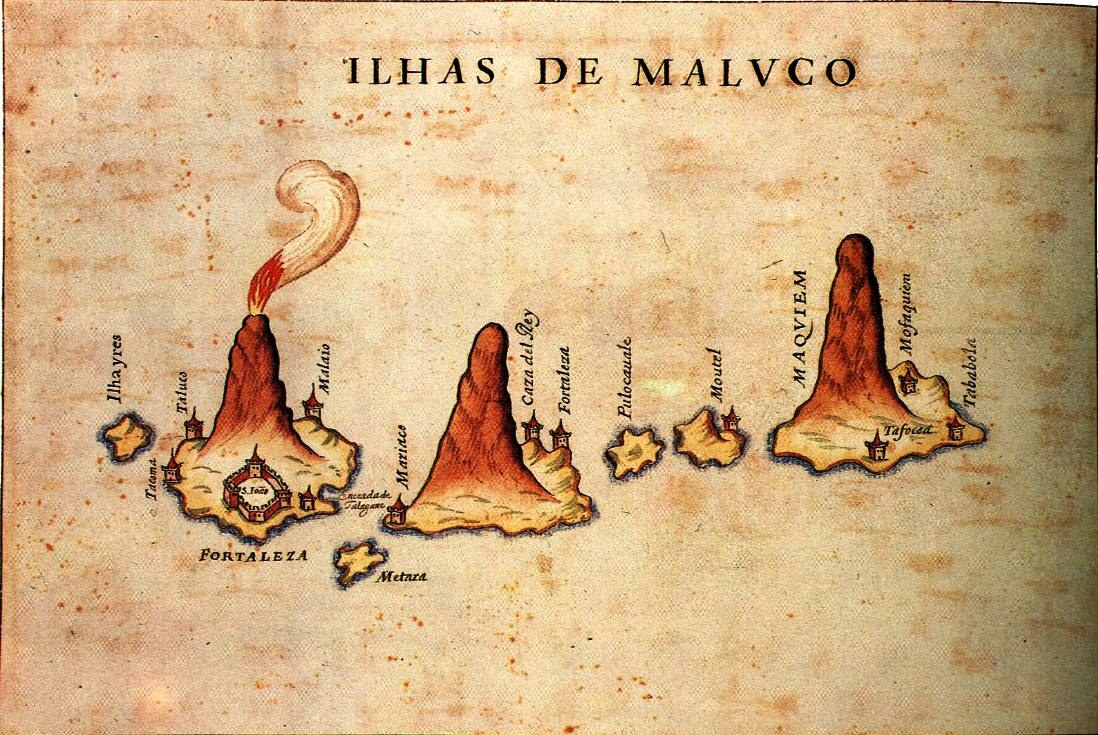
Finally, on the eighth day of November, they sighted the famed row of tropical volcanoes, the Moluccas; the only places on the entire planet where priceless clove trees grew.
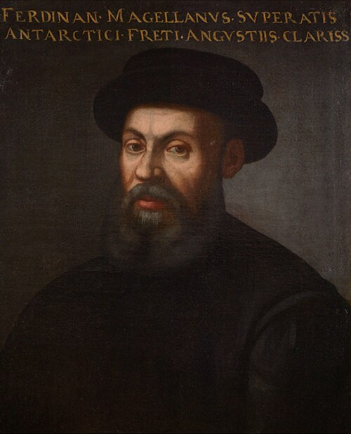
Ferdinand Magellan sailed with the Portuguese to India and Malacca, then switched to the service of Spain when he convinced King Charles that the riches of the Spice Islands was in Spain's domains, not Portugals. He died in a skirmish in the Philippines in 1521.
The Spanish anchored at Tidore Island. It shared control of the Moluccas with its neighbouring island, Ternate, just a cannon shot away. These islands had first been ‘discovered’ by the Portuguese in 1512 by a captain named Francisco Serrao; a friend of Magellan’s.
From Ternate, Serrao had written to Magellan asserting (incorrectly) that the Spice Islands lay in Spain’s domains, and to verify this fact was part of the reason that Magellan had convinced Spain to fund his expedition in the first place.
As the European discoverer of the world’s richest and most eagerly-sought spiceries, Serrao had abandoned his Portuguese roles and lived on Ternate as an advisor to the sultan for the last ten years, marrying a local princess and facilitating clove purchases for occasional Portuguese trading carracks, but with no desire to return to Portuguese service. He died of poisoning about the same time as Magellan met his end on Mactan, not far away and just a few months before the Spanish ships arrived at nearby Tidore.
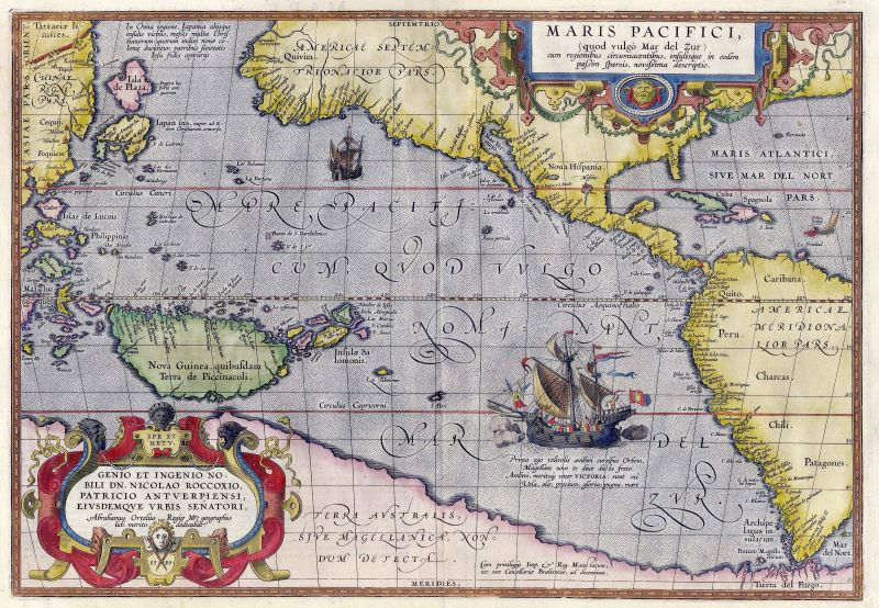
The first map of the Pacific Ocean, Maris Pacifici, was published in 1591 by Abraham Ortelius, reflecting information gathered from the Magellan/ Elcano voyage. The Spice Islands are at the extreme left.
The only other European in the Moluccas at that time was a Portuguese trader/ adventurer named Pedro Lorosa. He had arrived in India sixteen years previously with the early Portuguese fleets, and had lately drifted around the eastern islands, spending time trading at Timor–for sandalwood–and Banda–for cloves–before moving to Ternate shortly after Serrao died.
On 8th November 1521, Lorosa looked out from Ternate across the narrow channel that separates it from its neighbour and adversary, Tidore, and watched the two Spanish ships drop anchor. Five days later, after sending a servant to the Spanish to confirm they were not hostile to him, he crossed the narrow strait himself and climbed aboard the Trinidad.
This was actually an overlooked but nevertheless momentous occasion in human history, as Lorosa meeting the Spainiards represented the very first time the circumference of the globe had been closed.
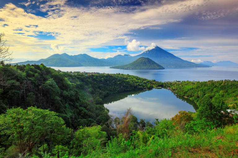
The spectacular line of tropical volcanos known as the Moluccas was the only place cloves grew. This view is looking south from Ternate towards Tidore where the Spanish ships dropped anchor in 1521.
Because, the Spanish had sailed west from Europe around South America and then crossed the great Pacific Ocean, a voyage that had traversed 233 degrees of longitude. In other words, they had circled more than half the earth, from just west of the prime meridian at Greenwich (0 degrees) to the modern International Dateline at 180 degrees (East and West), and then from there proceeded another 53 degrees west to 127 degrees East (180-127) to arrive at Tidore.
The Portuguese on the other hand had arrived in the Spice Islands by sailing east from Europe. They had passed 127 degrees of longitude, sailing around Africa. The Iberians had together closed the girth of the world for the first time, and done so from opposite directions, almost on the equator (which is just 75 km or 40 nautical miles south of Tidore).
Both had passed through the North and South Atlantic, while the Portuguese had also traversed the Indian Ocean and a smidgin of the Pacific, with the Spanish covering the entire breadth of the immense Pacific–by far the largest of the world’s oceans.
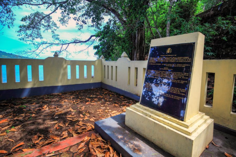
The Spanish memorial on the island of Tidore marks the spot offshore where the Spanish ships Victoria and Trinidad anchored in 1521. Pedro Lorosa came aboard just offshore and soon defected to the Spanish. He was later captured and executed by the Portuguese for treason when they arrived in pursuit of Magellan's ships. Victoria would leave this cove and return to Spain, completing the first circumnavigation of the globe.
Each of the Portuguese and the Spanish journeys were around 16,000 nautical miles, while the earth’s circumference–at the equator–is around 21,640 nautical miles, indicating clearly the impossibility of sailing around the globe at the equator. There are a lot of continents in the way! Which is why the Suez and Panama canals were built.
While both Iberian navigators possessed compasses and astrolabes and could estimate their latitude (their north/ south location) and approximate track, they were unable to estimate longitude (east/ west location) accurately, and poorly understood magnetic deviation, which varies with every year. It was therefore an incredible achievement, defining the span of the globe for the first time in history! And this was over 500 years ago!
On top of this forgotten accomplishment, one of the Spanish ships, the Victoria, under Juan Sebastian Elcano, would leave Tidore a month later and go on to complete the first circumnavigation of the earth by sailing west and returning to Seville on 8th September 1522. With Elcano were just 17 other circumnavigators of the 270 that had set out.