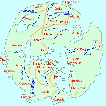
This astonishing map could more properly be called a Road Map of the Roman Empire, coming down to us from the fourth century AD. As such, it is a remarkable testament to the extent and sophistication of that empire, extending as it did at the time, from Britain to the frontiers of India.
While the surviving version of this map is a much later copy, the lost original it is based on was produced around 300 AD, probably modelled on earlier works that date back to the first century.
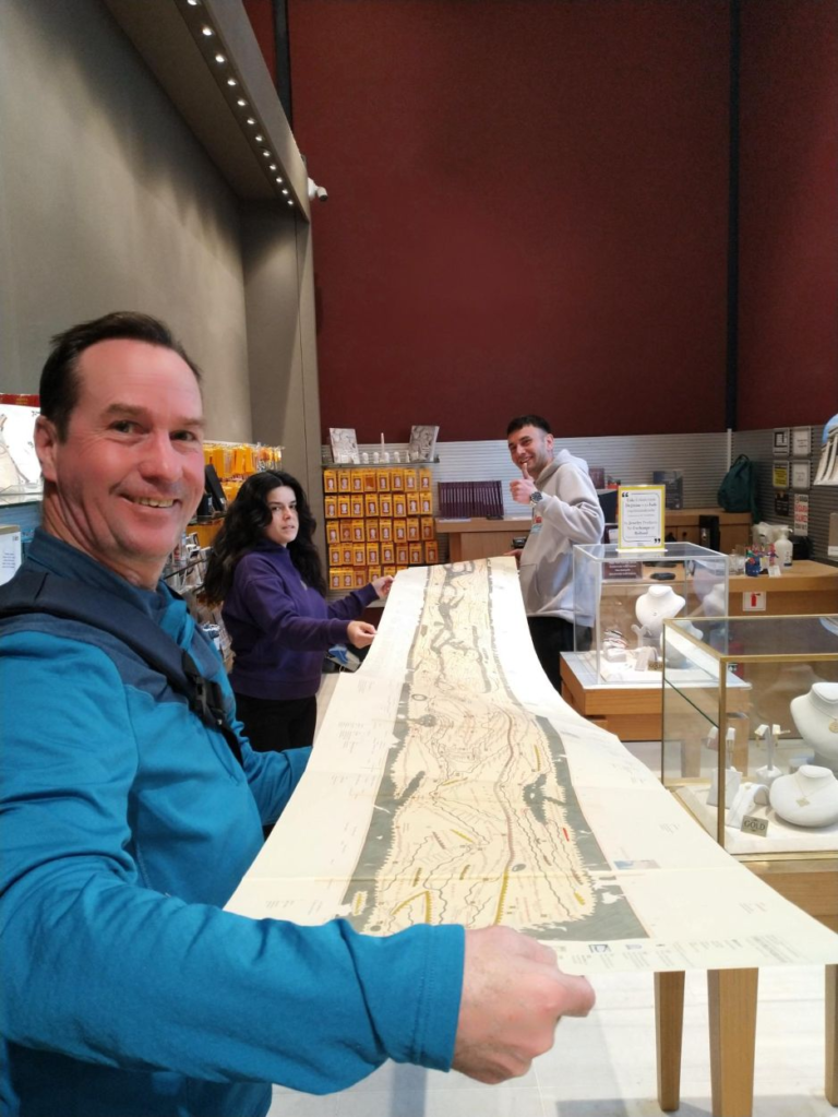
The folded-out map is nearly 7 metres long! The bookshop in Istanbul didn’t really know what they had. They were shocked! So was I.
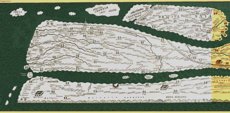
The most notable feature of the map that strikes you when you first see it is its width. It is nearly seven metres wide, and just 30 cm or so high. This allowed the whole empire to be rolled up into a standard capsa, or roll box, and easily carried on horseback. But it also meant that the vertical and horizontal scales differ greatly, and that north is not always upwards.
In that sense, it is more a stylised reflection of the girth of the empire to assist in travel, or perhaps military planning and strategy. Another suggestion is that its purpose was to reinforce the might, power and diversity of the lands under Rome’s sway, during a period when the vast empire was under threat from northern raiders and budgetary problems.
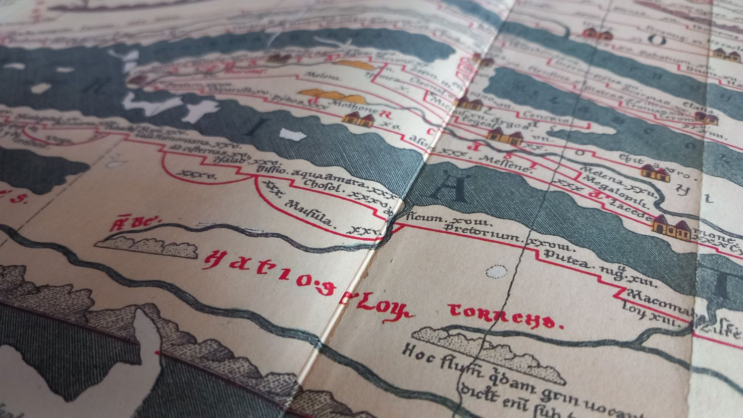
What is accurate though is the 200,000 km of roads shown in red ink, with distances marked in Roman miles–each of 1000 strides for a legionnaire– or, further to the east, in Persian leagues–the stretch a horse plods in one hour, or 6.38 km.
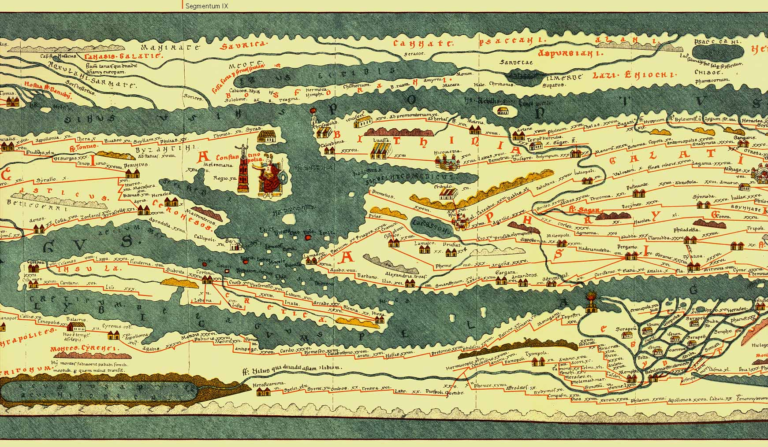
A section of the map shows the new Imperial capital at Constantinople, which replaced Rome, and was renamed from Byzantium in 330 AD. To the right of Constantinople is the Bosporus, above is the Black Sea, below it is the Dardanelles, the island further south is Crete, and the coast further south is modern Libya and Egypt. The large river mouth in Egypt is, of course, the Nile.
The distance a messenger could ride in one day is represented on the map between two settlements, generally shown as twin house structures. Apart from roads themselves, also shown are ports, lighthouses, mountain ranges, forests, thermal baths, even bridges. And of course, cities; over 550 of them, and another 3500 places are named, from far west to deep east.
The greatest cities of empire, Rome, Jerusalem, Antioch and Constantinople are highlighted, but other modern cities such as Rotterdam, Frankfurt, Augsburg, Milan, Athens, Alexandria, Ephesus, Bodrum, Damascus, Tbilisi, Tehran and Babylon can also be seen.
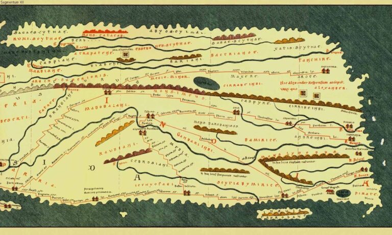
The eastern-most section of the Peutinger Map shows the island of Tabrobane - Sri Lanka - and the land of 'Pirate'. You can also see the Ganges and the Roman trade port of Muziris. It represents the very farthest of Roman knowledge of the world. Above a long mountain range (that extends back to Turkey) you can see the inscription regarding Alexander the Great.
The eastern portion of the map–beyond the frontiers of Rome–range through the lands of the Persian Empire, beyond which the Romans knew little about. Campaigning Roman and later Byzantine armies reached as far as modern Armenia and Iraq at various times, but beyond that was the old satrapies of Alexander the Great’s empire.
In the far north-eastern quadrant of the map, in furthest Asia, a point is marked with the caption ’End of the Land of Alexander the Great’, which represents his most distant campaign, near modern Islamabad.
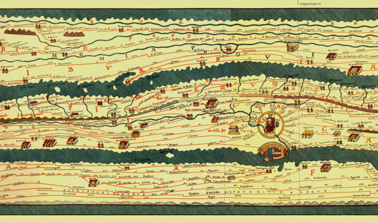
The section of the map showing Rome. By the time this version was made in the fourth century, Rome had already relinquished its role as administrative capital of empire. It would be sacked by the Visigoths in 410 AD. North Africa is below Italy, and the Adriatic coast above.
While the eastern land extent of Eurasia was something of a mystery to the Romans, they did have a much better understanding of the Indian Ocean. Egypt was a province of Rome from 30 BC and throughout Byzantine times to the mid-seventh century, and from it in the first few centuries AD, Roman vessels carried out substantial trade with India, using Muziris as their main port.
Muziris, whose modern location is contentious, but most likely in today’s Kerala state, was in southern India, and is marked clearly on the map. Nearby, to the west (should be east) lies a large island named Tabrobane, which is the old name for modern Sri Lanka. After Muziris, the coastline turns northward, passes through a land named ‘Pirate’–conceivably a reference to the corsair-ridden Malacca Strait–and we come to a great river called the Ganges. Beyond that is the lands of Scythia. It is all a little vague, as you would expect so far from Rome, but there are some locations, like Muziris, the Ganges and Tabrobane that we can recognise, even today.
The lost western section of the twelfth century copy of the fourth century version of the first century original was added to the base map in 1912, adding the Iberian peninsula, part of North Africa and the British Isles.
Tabula Peutinger is an amazing piece of cartography, perhaps the most amazing there is, given its age and provenance. It is printed on parchment, cut into eleven sheets. The western most sheet was missing but was added by extrapolation early in the twentieth century, giving us the British Isles and Iberia.
While scholars date the surviving manuscript to a monk’s copy from the twelfth century, the chart it was copied from was made after 328 AD, because it shows Constantinople, later capital of the Byzantine Empire, which was founded that year. Destruction of some cities shown on the map occurred in the fifth century, and another named kingdom, Francia, only emerged at this time, so what we see today was probably created in the late fourth century.
It is also argued that the map was likely to be based on a system of regularly updated empire maps that began with the apparently magnificent–but also tragically lost–marble-carved world map by Roman general Marcus Agrippa once housed at the Porticus Vipsania in Rome.
The Peutinger Map’s name comes from the scholar/ collector who came across it in 1508, gifted from the librarian of the Austrian emperor (who is likely to have plundered it from elsewhere). Konrad Peutinger identified it as a copy of a much older Roman map and bequeathed it through his estate to eventually arrive in the Österreichische Nationalbibliothek in Vienna.
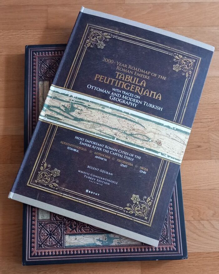
The map’s delicacy has meant is not on public display. It has been shown to visitors only once, for a single day in 2007. It is classified by UNESCO. I found a reprint by Turkish publisher Boyut which has a full, foldout map, with various notations and explanatory notes. It is great to get out at parties! If you go for Boyut, make sure you order the English version. Enjoy!
A modern boxed update of the Peutinger Map available from Boyut Publishers, in Turkey.